Jambo Geospatial tools and features
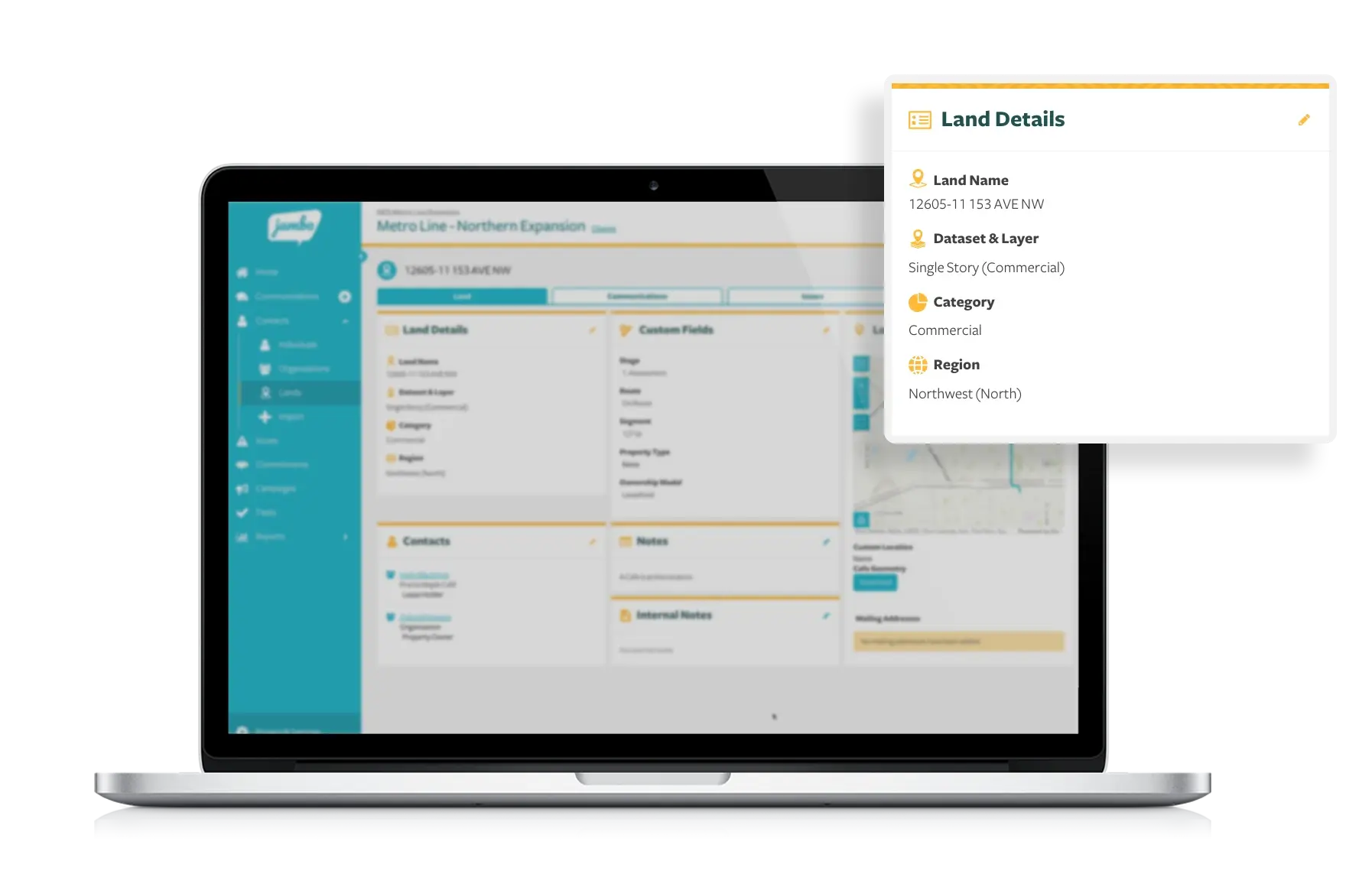
- Manage locations like contacts: Our new 'Lands' contact type allows you to link all engagement records directly to a specific location or property, maintaining a complete history of interactions even through changes in ownership.
- Automatic address geocoding and mapping: When you add an address to a contact or communication record, it is automatically converted into a precise geographic coordinate and pinned on the map viewer.
- Create and visualize project area maps: Easily upload or generate project boundaries on the project dashboard map. This clear visualization provides your team with an understanding of the project's location and scope, supporting better collaboration and spatial awareness.
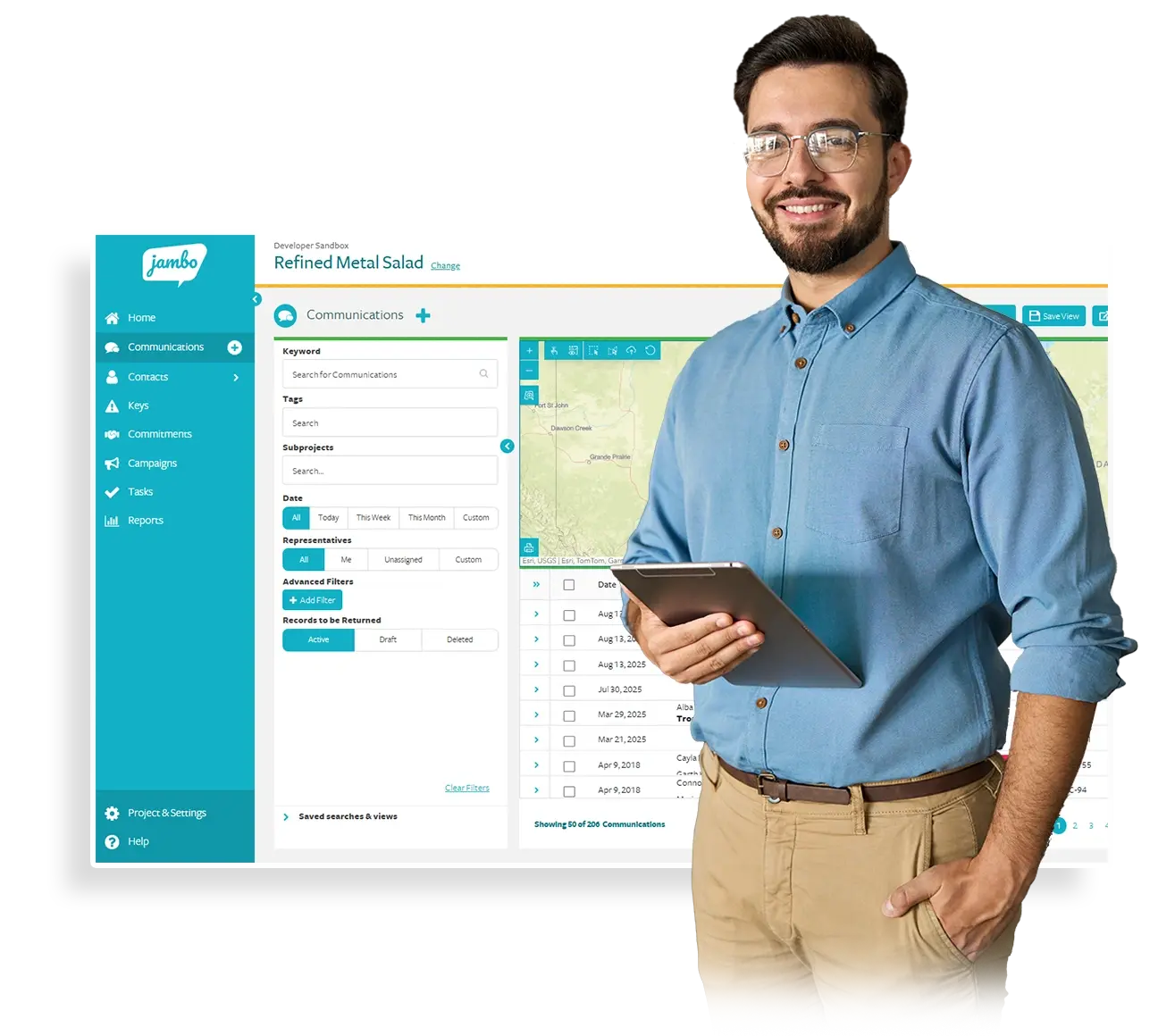
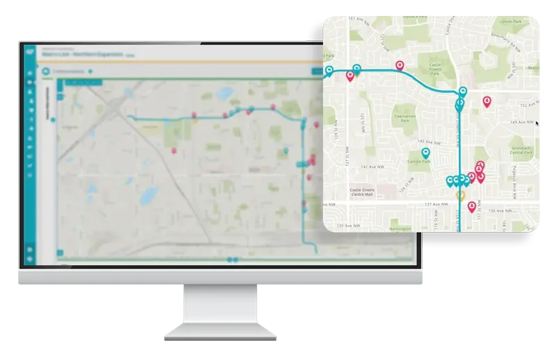
- Embedded map viewers: An Esri-powered map viewer is built into the contact and communication record index search grids. This lets you view your key stakeholder engagement data geographically. Filtering by communication sentiment, tags, or other criteria can reveal spatial patterns highlighting concern or interest hotspots or priority areas.
- Map layers and base maps: You can adjust the information on your maps by toggling layers showing contacts, communications, and project areas. You can also switch between base map options, such as satellite imagery or street views, to choose the geographic perspective that best suits your needs.
- Jambo for ArcGIS Pro add-in: For teams using Esri ArcGIS Pro, the free add-in lets you seamlessly connect to and import spatial data directly into Jambo projects and accounts. This powerful integration brings advanced spatial analysis to your engagement projects.
How Jambo Geospatial helps you use the power of location intelligence to improve engagement effectiveness
Harnessing the power of location intelligence, Jambo Geospatial reveals the complete geographic story behind projects, stakeholder interactions, and emerging concerns. Visualizing data in a geographic context uncovers patterns and relationships that might otherwise go unnoticed, enabling you to understand what is happening and where clearly. This empowers you to prioritize outreach efforts, monitor critical areas, and maintain comprehensive engagement records linked to properties regardless of ownership changes.
Enhance engagement strategy and resource allocation
With built-in map viewers, you can easily see your project area mapped alongside the people, organizations, and communities you've engaged with, giving your team a clear visual overview. Quickly identify zones of high engagement and pinpoint areas with emerging concerns or common interests.
Filter communications by sentiment and use the map viewer to highlight areas needing extra attention. This enables you to prioritize outreach strategically and address issues before they escalate.
Empower your team to track stakeholder concerns and engagement progress with ease. When common frustrations arise in specific locations, it signals the need for focused follow-up and deeper investigation. Location-based insights help you respond proactively and allocate resources more effectively.

Understand the whole history of engagement with any property, regardless of ownership
Jambo revolutionizes stakeholder management by treating locations (properties, parcels of land, etc.) as contacts with detailed engagement history profiles. 'Lands' is a new contact type in Jambo that allows you to directly link every interaction, from communications and issues to long-term commitments, to a location.
By linking every conversation and event directly to a location, you ensure that a complete and permanent history of engagement is preserved (regardless of property ownership changes).
This land-centric approach safeguards your institutional knowledge, so your team's understanding of any property's full story remains intact.
Effortlessly add location information
- Pinpoint locations using our Esri-integrated maps, which are available in contacts and communications. Simply add a pin to the map for precise location tracking.
- Our built-in geocoding tool converts addresses into exact geographic coordinates (latitude and longitude), automatically placing them accurately on the map viewer for seamless visualization.
- Easily manage large datasets by importing Lands (location-based contacts) using our simple Excel import template, making bulk location data uploads quick and efficient.
- Integrating geospatial data through our free ArcGIS Pro add-in can enhance your spatial analysis, bringing advanced mapping capabilities directly into your workflow.
Frequently Asked Questions (FAQs):
Jambo Geospatial
Jambo Geospatial features and tools enable organizations and government teams to seamlessly incorporate spatial data into stakeholder engagement workflows, unlocking the power of maps and location intelligence to improve engagement effectiveness.

Want to know more? Our friendly sales team is always here to help. You can reach us at hello@jambo.cloud.
If you're a Jambo customer and want to learn more about enabling Jambo Geospatial, our customer success team is always here to help. Please feel free to email them or submit a helpdesk ticket with any questions.
What is Jambo Geospatial
How does Jambo Geospatial help with stakeholder engagement?
Can Jambo Geospatial manage locations, not just people?
How does Jambo automatically map addresses?
What mapping features are included in Jambo Geospatial?
Jambo offers features such as:
- The ability to create a project area dashboard map(upload or generate project boundaries).
- Integrated map viewers on the contact and communication record index search pages.
- Flexible map layers, base map options (including satellite and street views).
- Precise location pinning and auto address geocoding.
Is Jambo Geospatial integrated with Esri technology?
How can I use Jambo Geospatial to prioritize stakeholder outreach?
Who can benefit from using Jambo Geospatial?

Jambo is trusted by governments and organizations worldwide


Stakeholder engagement, simplified
Connect all your stakeholder engagement information in one secure platform. With minimal training to get started, you can focus on engaging with your stakeholders rather than managing the data.